Model Submission Guidelines
Model Submission with groundplan
Updated: July 6, 2021
Very Simple Model Content Standard
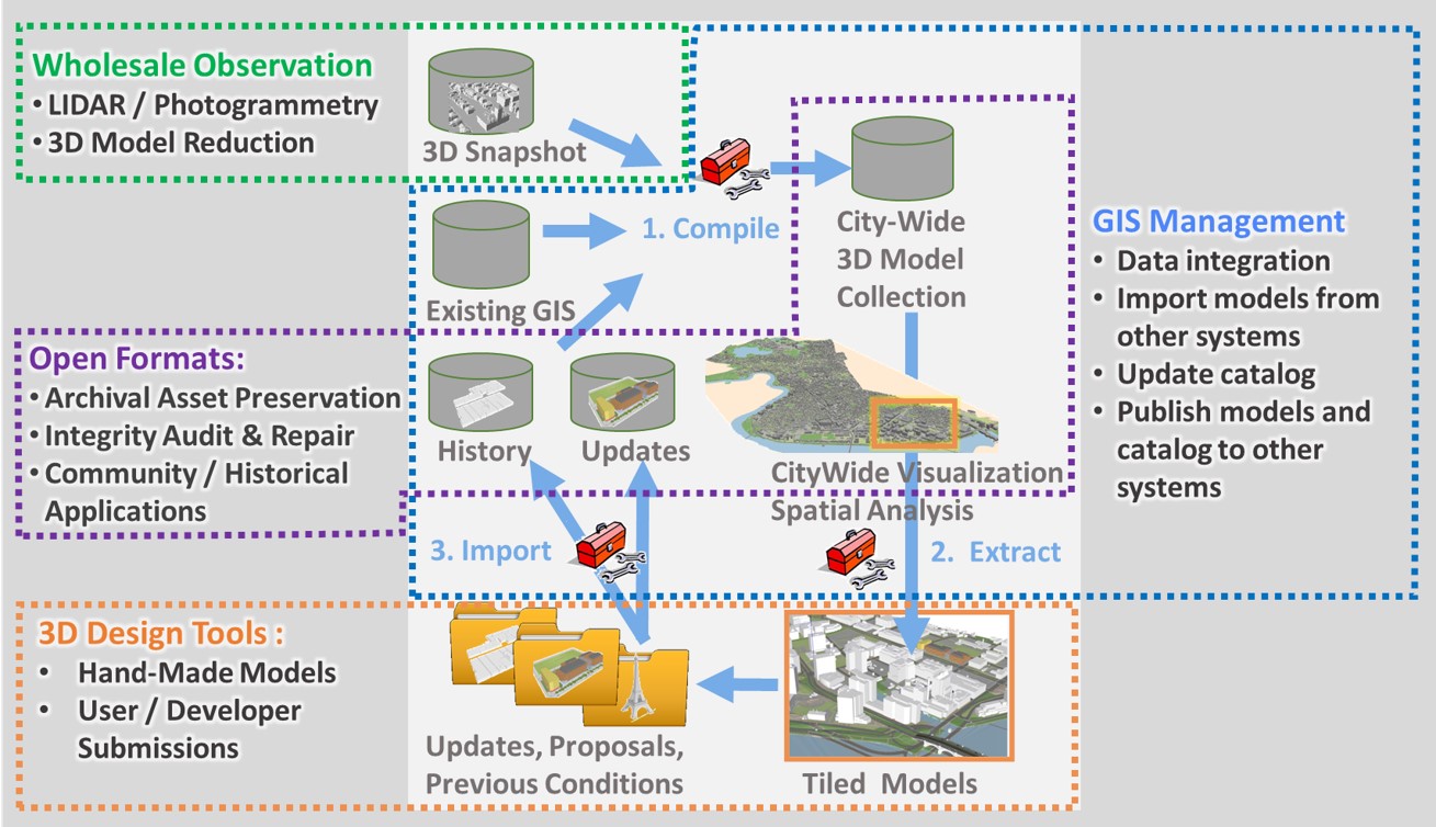
Building and Bridge models in the BPDA's city model collection are managed in a geographical database that treats models as singular objects associated with attributes. In this context, models do not have any subdivisions such as Layers or nested groups. This makes the model collection simple to manage without much need for a detailed specification or normalization of model organization. Building models are mesh objects representing the exterior shell of the building.
Model Level of Detail
Here are some additional guidelines for model geometry level of detail:
- If a project has multiple buildings or construction / permitting phases it is best if these are separated into individual .OBJ files.
- If a building is separated into separate functional spaces that can be visualy distinguished from the outside, like parking structures, these can be submitted as individual OBJ files but this is not a requirement.
- Our preferred level of detail is LOD 3.0 (See our Level of Detail dictionary) Which may potentially represent overhangiing elements like porticos and entryways. If parts of the building protrude beyond the vertical facade by more than a foot and are more than a foot tall, they may be included.
- Window openings should not be cut out or indented.
- Our context model includes detailed terrain. Your model should properly represrnt the elavations of ground-leveldetails like entryways.
- To avoid awkward floating corners whenusing different terrain models, it is helpful if your model has a margin of a fwew feet projectingbelow the ground.
- Representing below-ground portions of the building is welcomed, but not necessary.
- If your building is attached to other buildings, it would be helpful to have separate models or discrete grouped geometry representing the the attached buildings.
- If your project has involved making improvements to the models of other buildings in the neighborhood, it would be great to have those, too!
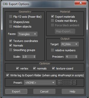
Recommended OBJ Format Options for 3D Max
Simple Wavefront Object Format
We have found that various 3D model formats allow geometry types that do not translate well when we import them into our GIS-Based management scheme. This is why we prefer that models be submitted as the simplest possible triangulated mesh in Wavefront Object format.
Our model asset management system treats OBJ format as a primary asset which are leveraged to various proxy formats, including GLTF, ESRI Multipatch and SketchUp. Each of these translations has potential for difficulty and corruption to creep in. Therefore we prefer that designers use their modeling tool to produce a simplified view of their building shells that can be exported as a simple triangulated mesh.
- Triangulate all faces (no parametric curves please)
- Orient axes: Z Up, Y Forward.
- Please do not use single faces that would have both sides exposed. Many tools wil represent these as invisible from one side or the other. Even if your software has an option for exportng "Two-Sided Faces"
- If your model uses materials and or textures, we would be happy to have these, although at this time, our workflow has to remove these. We will keep your textured model in the archive.
Production of a simple shell view is routine if the modeler anticipates the need and has access to the model in its original format.
Context and Geo-Location
We need some means of verifying the placement of your model in the context of our existing city model. This is tricky, since most modeling tools have trouble with geometry in very expansive coordinate systems that are used in state and local agencies. The agency has developed a tiling and coordinate referencing scheme that bridges between design tools and GIS. In short, keeping our tile frame in your model permits you to have your origin wherever works best in your project, but to re-register your model exports back and forth with the collaborative city model coordinate system.
You can read all about it on our Tile Grid and Coordinate System page.- if it is possible for you to submit your model using our Metro Boston 3D coordinate referencing system, that would be preferred. If you have difficulties doing this, we would like to hear more about that.
- We know that you wil be working in a project-based coordinate system. If shifting back to the Metro 3D Boston coordinate system is too much to ask, it could be very helpful to include the tile boundary in your model -- which would give us a dependable registration.
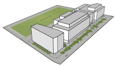
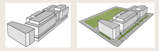
- If possible, include a ground-plan with a draped image texture as shown in the illustration above. The groundplan should show enough of the edge of pavement in the context area to verify that the model is registered correctly.
Optional Source Material
Our archival system is capable of storing source material, including the plans and elevations and other information that may be part of the project proposal. We can also keep working models -- for example SketchUp or .3DS files. We are Sketchuip Users, so if you have a SketchUp file of your model this may be helpful in case we need to do any trouble-shooting.
On-Going Work In Progress
This submission procedure is a work in progress, so we anticipate problems and hope to work with the development community to make it as easy as possible to participate in building our collaborative open=-source city model!